|
|
![]()
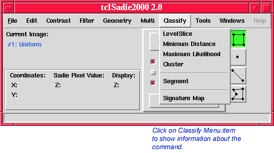
The Classify menu provides commands for applying supervised and unsupervised image classification (labeling) techniques to an image, as well as a command for creating a class signature map from a label map and the original image.

The LevelSlice command performs non-parametric, supervised classification on pixels in the input image, using a supervised level slice or "box" classifier. The Region Selection Tool (main screen) must be used to define training classes for the image. A maximum of 32 classes may be defined. The LevelSlice command is not enabled until such training classes exist in some image. A class is defined by its graylevel minimum and maximum in each band of the image. Class information and boundaries are retained between invocations of the Levelslice command.
The label of a pixel in the output label map O is computed from the graylevel of the corresponding pixel in the input image I as
![]()
where the input image is of size m-by-n-by-o, and ![]() and
and ![]() are the graylevel minimum and maximum, respectively, for class
c and band i, as specified in the dialog. Pixels falling within two or more
class boundaries are assigned labels by the nearest-mean algorithm.
are the graylevel minimum and maximum, respectively, for class
c and band i, as specified in the dialog. Pixels falling within two or more
class boundaries are assigned labels by the nearest-mean algorithm.
Please see Robert A. Schowengerdt, Remote Sensing: Models and Methods for Image Processing, Academic Press, San Diego, CA, 1997, pp. 411-412 for further discussion of this classifier.
The LevelSlice command is useful for rapid, non-parametric supervised image classification.

The Minimum Distance command performs non-parametric, supervised classification on pixels in the input image, using the minimum distance betweeen the pixel's feature vector and the closest training vector. The command provides three methods of distance measurement:
Please see Robert A. Schowengerdt, Remote Sensing: Models and Methods for Image Processing, Academic Press, San Diego, CA, 1997, pp. 413 for further discussion of this classifier.
The Region Selection Tool (main screen) must be used to define training classes (vectors) for the image. A maximum of 32 classes may be defined. The Minimum Distance command is not enabled until such training classes exist in some image. Class information and boundaries are retained between invocations of the Minimum Distance command.

The Maximum Likelihood command calculates the a posteriori probability of class membership betweeen the pixel's feature vector and the closest training vector in accordance with Bayes Decision Rule. The probability values are listed in the Session Log for each class.
The Maximum Likelihood command is currently UNDER CONSTRUCTION and does NOT produce a classification image.
Please see Robert A. Schowengerdt, Remote Sensing: Models and Methods for Image Processing, Academic Press, San Diego, CA, 1997, pp. 424-426 for further discussion of this classifier.
The Region Selection Tool (main screen) must be used to define training classes (vectors) for the image. A maximum of 32 classes may be defined. The Maximum Likelihood command is not enabled until such training classes exist in some image. Class information and boundaries are retained between invocations of the Maximum Likelihood command.

The Cluster command performs non-parametric, unsupervised classification on pixels in the input image, based on their "natural grouping" in feature space. The classes (clusters) are determined in an iterative process. Parameters are the number of iterations, the number of seed classes, the minimum class size, a distance threshold for merging adjacent classes, the pixel and line increment for graylevel subsampling, and an outlier threshold that is used only in the final classification. This procedure is also known as the K-Means Clustering Algorithm.
Pixels are assigned labels based on the proximity of their graylevel values to the graylevel means of the clusters. Initially, the class means are distributed uniformly across the m-dimensional feature space. Using the city-block distance criterion, each pixel is then assigned to the class with the closest mean. New class means are computed from those clusters, and the pixels are re-assigned to the classes. This process is repeated until the number of iterations specified in the dialog has been reached. If, during the iterative process, the number of pixels in any given class falls below the minimum class size specified in the dialog, that class is removed from subsequent iterations by allowing its pixels to be absorbed into other classes. Similarly, if two cluster means become, in each feature dimension, closer than the class merging threshold specified in the dialog, the corresponding classes are merged. Two classes c and d are merged if
![]()
where ![]() and
and ![]() are the graylevel means for classes c and d in band i,
are the graylevel means for classes c and d in band i, ![]() and
and ![]() are the graylevel standard deviations for classes c and d in band i, and
are the graylevel standard deviations for classes c and d in band i, and ![]() is the class merging threshold, as specified in the dialog. Recommended
values for this parameter are between 0.0 (no merging) and 1.0.
If two classes are merged, the resultant class is not permitted
to be merged with any other class in the same iteration. If the
minimum class size and the cluster merging threshold are set to
one and zero, respectively, the final number of classes is equal
to the number of seed classes. This algorithm is described in
more detail in R. D. Duda and P. E. Hart, Pattern Classification and Scene Analysis, J. Wiley & Sons, New York, NY, 1973, and in Robert A. Schowengerdt,
Remote Sensing: Models and Methods for Image Processing, Academic Press, San Diego, CA, 1997, pp. 403-409.
is the class merging threshold, as specified in the dialog. Recommended
values for this parameter are between 0.0 (no merging) and 1.0.
If two classes are merged, the resultant class is not permitted
to be merged with any other class in the same iteration. If the
minimum class size and the cluster merging threshold are set to
one and zero, respectively, the final number of classes is equal
to the number of seed classes. This algorithm is described in
more detail in R. D. Duda and P. E. Hart, Pattern Classification and Scene Analysis, J. Wiley & Sons, New York, NY, 1973, and in Robert A. Schowengerdt,
Remote Sensing: Models and Methods for Image Processing, Academic Press, San Diego, CA, 1997, pp. 403-409.
In the final classification pass, the label of a pixel in the output label map O is computed from the graylevel of the corresponding pixel in the input image I as

where the input image is of size m-by-n-by-o, N is the number of classes as determined by the iterative process,
![]() and
and ![]() are the graylevel means for classes c and d in band i, respectively,
are the graylevel means for classes c and d in band i, respectively, ![]() is the graylevel standard deviation for class c in band i, and
is the graylevel standard deviation for class c in band i, and ![]() is the outlier threshold, as specified in the dialog.
is the outlier threshold, as specified in the dialog.
The Cluster command is useful for non-parametric, unsupervised image classification. The stability of the clusters is determined, to a large extent, by the number of iterations. Using this algorithm, image data generally converges to a stable result after three or four iterations; however, it is advisable to look at the average mean vector migration values to confirm stability. The subsample increment parameter, which is used only in the iterative determination of the clusters, but not in the final classification, allows a tradeoff between accuracy and speed. A smaller value uses more pixels to determine the clusters and is therefore relatively slow; a larger value uses fewer pixels and is faster. When image subsampling is used, an increase in the average mean vector migration value is common for the final classification. This is usually a consequence of the change to full sampling and does not necessarily represent a true increase in average migration. Note that if subsampling is used, it may be advisable to increase the minimum class size.

The Segment command classifies pixels in the input image based on graylevel homogeneity and region connectivity. Parameters are two graylevel thresholds, which together define the homogeneity of the resulting regions. The spatial resolution of the input image may optionally be reduced by pixel averaging and subsampling before the image is subjected to the segmentation process. In this case the resulting label map is refined back to the resolution of the original input image. The result of the Segment command is a signature map which may be used to classify the original image using the Signature Map command.
Pixels in the output image are processed from left to right and top to bottom. If a pixel can be merged (according to the criterion given below) with either the region directly above or directly to the left of it, it is assigned that region’s label. If it can be merged with either segment, it is assigned the label of the "closer" segment (again in the sense of the merge criterion). Otherwise, it begins a new region and is assigned a new label. If the pixel is merged with one of the two neighboring segments, a test is performed to see if those two segments can be merged. This technique ensures that all created regions are four-connected.
Two regions P and Q are merged if
![]()
where the input image is of size m-by-n-by-o, t is the graylevel difference threshold, and s is the graylevel variance threshold, as specified in the dialog,
![]() and
and ![]() are the mean graylevel values for regions P and Q in band i, respectively, and
are the mean graylevel values for regions P and Q in band i, respectively, and ![]() is the graylevel standard deviation for the resulting (merged)
region in band i.
is the graylevel standard deviation for the resulting (merged)
region in band i.
The details of the segmentation algorithm, as well as the resampling and refining steps, are described in G. Mehldau, "An Image Segmentation Algorithm," University of Arizona, Digital Image Analysis Lab, Technical Report No. 90—3 (November 1990). The segmentation procedure is a modification of the technique described in T. Ryan, "Image Segmentation Algorithms," SPIE, Vol. 534 (1985), pp. 172—178.
The Segment command is useful for unsupervised image classification of spatially homogeneous regions. Each such region has a unique label (class) assignment. The label map may therefore be useful for counting objects on a uniform background. When the label map is combined with the original image via the Signature Map command, the result is a non-linearly smoothed version of the original image. This smoothed image may then be submitted to the LevelSlice or Cluster commands for feature space classification. Note that resolution reduction is useful to avoid too small or too many segments; however, it does not necessarily result in a reduction in computation time. Also note that segmenting an image is a memory-intensive operation.

The Signature Map command creates an output image of class signatures from a label map and the original image. The label map is created using the Segment command. The two images, which must have the same number of lines/band and pixels/line, are chosen from pop-up menus of all images currently open.
The graylevel of a pixel in the output image O is computed from the label of the corresponding pixel in the label map I and from the original image J as
![]()
where ![]() (i.e., each pixel in the class signature map is represented by
the average graylevel of its class).
(i.e., each pixel in the class signature map is represented by
the average graylevel of its class).
The Signature Map command is useful for visualizing the performance of a classifier in terms of its effect on the image signatures. It is particularly useful for results produced by the Segment command, because its label map typically has a very large dynamic range and the labels are not correlated to the graylevels of the original image. The signature map may be subtracted from the original image (using the Multi > Combine command) to visualize the classification "reliability", in terms of within-class variability. Generally, the greater the deviation of a pixel from its classification signature (class mean), the lower the reliability.
Last Updated: August 2000
University of Arizona
Electrical and Computer Engineering Department
Digital Image Analysis Laboratory © 1999,2000